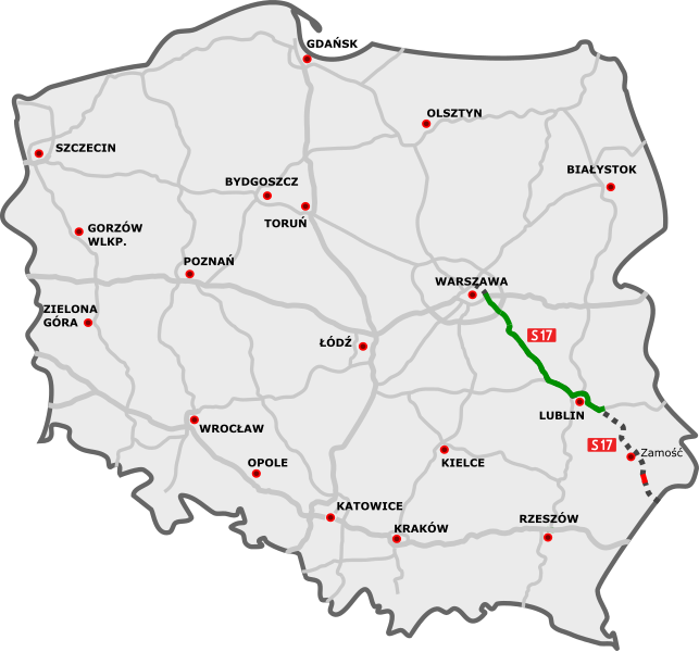
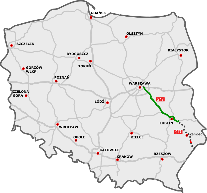
File:NowaMapaS17.svg
Jump to navigation
Jump to search


Size of this PNG preview of this SVG file: 643 × 599 pixels. Other resolutions: 258 × 240 pixels | 515 × 480 pixels | 644 × 600 pixels | 824 × 768 pixels | 1,099 × 1,024 pixels | 776 × 723 pixels.
Original file (SVG file, nominally 776 × 723 pixels, file size: 179 KB)
Summary
| Description | |||
| Date | |||
| Source |
|
||
| Author |
|
||
| SVG development |
|
Licensing
I, the copyright holder of this work, hereby publish it under the following license:
This file is licensed under the Creative Commons Attribution 3.0 Unported license.
- You are free:
- to share – to copy, distribute and transmit the work
- to remix – to adapt the work
- Under the following conditions:
- attribution – You must give appropriate credit, provide a link to the license, and indicate if changes were made. You may do so in any reasonable manner, but not in any way that suggests the licensor endorses you or your use.
Original upload log
This image is a derivative work of the following images:
- DocelowyUkladDrog.svg licensed with Cc-by-3.0
- 2009-11-05T17:29:06Z Sliwers 785x724 (157031 Bytes) Minor tweaks to the S19
- 2009-10-26T18:20:44Z Sliwers 785x724 (156964 Bytes) Next attempt
- 2009-10-26T17:50:36Z Sliwers 784x723 (156985 Bytes) Updated according to the newest version of the plan
- 2009-09-22T16:31:17Z Sliwers 784x723 (153828 Bytes) Zgorzelec/Jędrzychowice
- 2009-08-31T18:21:25Z Sliwers 784x723 (153823 Bytes) Colors
- 2009-08-30T16:41:32Z Sliwers 784x723 (155471 Bytes) Darker color.
- 2009-08-30T16:40:18Z Sliwers 784x723 (155471 Bytes) Cropped.
- 2009-08-30T16:36:58Z Sliwers 1073x790 (154212 Bytes) {{Information |Description={{en|1=Map of the planned free- and expressway network in Poland.}} {{pl|1=Docelowy układ autostrad i dróg ekspresowych w Polsce.}} {{de|1=Das Autobahn- und Schnellstraßennetz Polens, geplanter E
File history
Click on a date/time to view the file as it appeared at that time.
| Date/Time | Thumbnail | Dimensions | User | Comment | |
|---|---|---|---|---|---|
| current | 18:55, 11 January 2021 | | 776 × 723 (179 KB) | Daniel749 | update |
File usage
The following page uses this file: